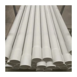
Inclinometer casing marine inclinometer sensor with good price
Product Description
The main performance characteristics:
WHAT IS AN INCLINOMETER?
An inclinometer is an instrument that uses the effects of gravity to measure its own tilt, or the angle of the slope at which it is lying, and by extension to measure changes in the substance supporting it—usually the ground or a part of a structure.
Inclinometer readings are normally given in degrees of the angle of deviation from a vertical or horizontal plane, as a grade percentage, or as absolute deviation in millimeters or inches.
WHAT ARE INCLINOMETERS USED FOR IN GEOTECHNICAL MONITORING?
Because inclinometers can detect their own orientation relative to gravity, they can also identify movement in the material they are installed in by comparing several readings taken at different points in time. In geotechnical monitoring, this information is used to detect many kinds of movement and deformation, both in the ground and in built structures. These movements include lateral movement, subsidence, and heave in the ground, as well as settlement and deflection in structures. Monitoring these movements is important in tracking stability during construction or repair work as well, and also in following long-term stability once work is
complete.
Inclinometers are used in dams and retaining walls of all kinds—from the smallest earthfill retaining walls to the largest concrete dams—to monitor stability in the structure and the ground that supports it.
Roadways, bridges, and tunnels also have applications for inclinometers, where they can be used to monitor the integrity of the box girders that support a bridge’s deck or alert to potential subsidence in the ground below an asphalt road surface.
Inclinometers are used in any project that involves excavation, such as open-pit mines or landfill sites. In these cases, inclinometers monitor deformation in the ground surrounding the excavated area in order to detect stability problems before they occur.
Product main technical specifications:
|
Product name
|
Vibroseis rebar gauge
|
Measurement accuracy
|
0.01°
|
||
|
measurement range
|
-90°~ 90°
|
0~105
|
0~136
|
||
|
Communication protocol
|
Standard Modbus-RTU protocol
|
||||
|
Signal output
|
RS485;
|
||||
|
Read interval
|
≥1s
|
||||
Product Description


Application
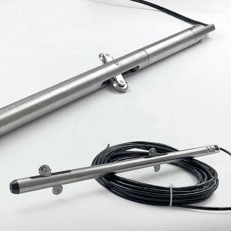
The Gemho Inclinometer enables long-term monitoring of deformations in structures such as dams, embankments, foundation walls, and similar applications.

Detailed Images

Stable and reliable
Underground permanent fixed/landfill mode is adopted, and vulnerable components such as storage unit, internal batteries and display unit are discarded. It has fewer accessories and is easy to install, which is more conducive to long-term monitoring
Underground permanent fixed/landfill mode is adopted, and vulnerable components such as storage unit, internal batteries and display unit are discarded. It has fewer accessories and is easy to install, which is more conducive to long-term monitoring
Measurement accuracy
The accuracy is 0.01 degree. The inclinometer directly outputs the inclination value when inclined, and the instrument isn’t affected by human factors after installation. The measurement of inclination change is a real change, and there is no repetitive accuracy error.

Industrial Standard Design
The overall use of 204 stainless steel material, industrial design, protection level IP67.
Professional customization
According to the design of mine slope safety monitoring, it’s more suitable for long-term, continuous, stable and accurate monitoring.


Reviews
There are no reviews yet.